To provide you with the best experience, cookies are used on this site. Learn more

To provide you with the best experience, cookies are used on this site. Learn more

To build your own Itinerary, click  to add an item to your Itinerary basket.
Already saved an Itinerary?


Southern Snowdonia Towns | Places to Stay | See & Do

Number of results: 256
, currently showing 181 to 200.
Gwynedd
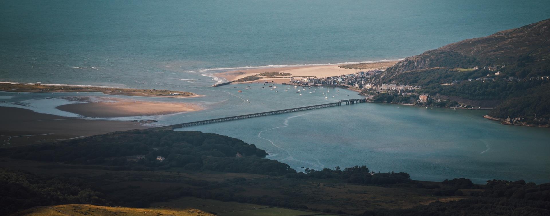
Barmouth is southern Snowdonia’s most popular seaside resort. In summer, its big sandy beach is a magnet for visitors, yet there’s so much space along miles of unbroken sands that it never gets overcrowded.

Machynlleth
Start: Ceinws village
Grid Reference: SH760 059
Distance: 11.3 km – 7 miles (additional 0.7km - 0.4 miles to Llanwrin)
Grade: Moderate / Strenuous
Terrain: Firm tracks, open fields
Maps: OS Explorer 215
Southern Snowdonia
The Precipice Walk is one of the famous attractions of Dolgellau. It passes through an interesting variety of habitats which include deciduous woodland, a conifer plantation, meadows, lakeside and sheep-walk.
Dolgellau
Sesiwn Fawr Dolgellau - Dathlu'r gorau o fyd gwerin a roc Cymreig | Celebrating the best of Welsh Folk and Rock.


Gwynedd
This 120 acre reserve is a fine example of Ancient Woodland, with a rich flora of mosses, liverworts and ferns. The Coed Crafnant Reserve is comprised of two distinct woodlands; Coed Crafnant and Coed Dolbebin.
Tywyn
Cadair Idris Visitor Centre & Tea Room is 250 metres from the car park and the Minffordd path to the Cadair Idris summit passes by them.
Dinas Mawddwy
North-east of Machynlleth and south-east of Dolgellau, the village of Dinas Mawddwy is just to the side of the A470 at the junction with the mountain road to Lake Vyrnwy and Bala.
Dyffryn Ardudwy
Dyffryn Ardudwy railway station is on the Cambrian Coast Line from Machynlleth to Pwllheli.
MACHYNLLETH
Start: Pennal village
Grid Reference: SH 699 004
Distance: 13.2km – 8.3 miles
Grade: Strenuous – A mountain walk, not to be undertaken in poor visibility
Maps: OS Explorer – OL 23
Llanuwchlyn, Bala
Join us at Bala Model Railway Show, a popular exhibition of detailed model layouts and exhibits held over 2 days at Ysgol Godre’r Berwyn Secondary School, Bala.
Dolgellau
Discover Dolgellau with its rich history and captivating architecture on the Dolgellau Town Trail. Begin and end your journey at Eldon Square in the heart of the town and meander through its irregular streets and admire the solid buildings.
Tywyn
Young Members Group Day - Celbrating our young volunteers!
Gwynedd
The Waun-oer Ridge Walk climbs from the village of Dinas Mawddwy over the bare mountains of Maesglase, Craig Portas, Cribin Fawr and Waun-oer and then down the slopes of Mynydd Ceiswyn to Bwlch Llyn Bach pass, Tal-y-llyn.
Aberdyfi
The Eyri (Southern Snowdonia) section of the Wales Coast Path providers the walker with the natural backdrop of the Eyri National Park.
Nr Dolgellau
Cregennan Lakes in southern Snowdonia are owned by the National Trust and are a renowned and often photographed beauty spot. There are tremendous views of the Mawddach Estuary and Barmouth Bridge from near the lake.and the lakes are situated on the…
Harlech
Harlech beach is an ideal place for children to play and an even better spot for adults to sit back and relax. The beautiful sand dunes are the reason behind the area’s designation as a National Nature Reserve and Site of Special Scientific Interest.
Aberdyfi | Aberdovey
This gentle four mile walk soon gets you up above Aberdyfi, enjoying fine views over the mouth of the Dyfi estuary and south towards Borth and Aberystwyth.
Starting place: Tourist Information Centre
Starting ref: SN 614959
Harlech
Harlech railway station is on the Cambrian Coast Line from Machynlleth to Pwllheli.

Dolgellau
A network of paths on the Coed Ganllwyd reserve mean you can choose from circular walks of 100 metres up to more demanding routes that stretch over two kilometres.
Blaenau Ffestiniog
Blaenau Ffestiniog railway station is the terminus of the Conwy Valley Line from Llandudno Junction; most trains run from/to Llandudno. Trains connect with the North Wales Coast Line. It is also the terminus of the Ffestiniog Railway.

© Visit Mid Wales 2026. All Rights Reserved

