To provide you with the best experience, cookies are used on this site. Learn more

To provide you with the best experience, cookies are used on this site. Learn more

To build your own Itinerary, click  to add an item to your Itinerary basket.
Already saved an Itinerary?


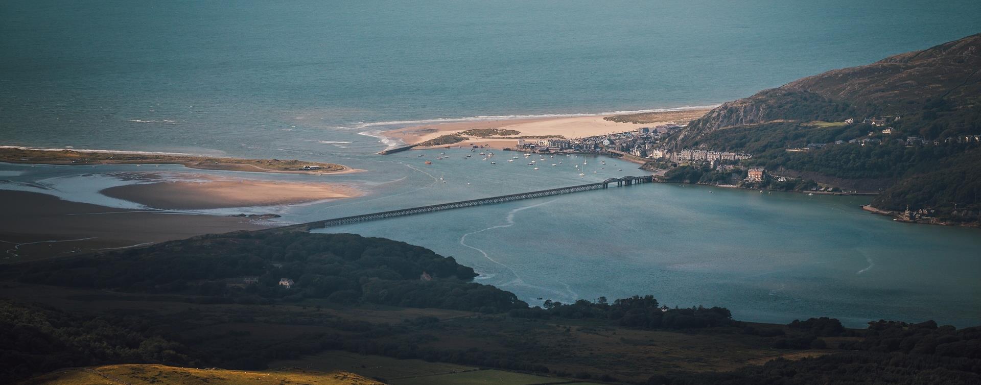
Southern Snowdonia Towns | Places to Stay | See & Do

Number of results: 256
, currently showing 241 to 256.
Dolgellau
Dolgellau is the ideal base to explore southern Snowdonia's dramatic scenery, adrenalin-fuelled activities and world heritage attractions. It's a historic mountain town built on the wool trade and steeped in folklore.

Southern Snowdonia
The walk along the estuary from Barmouth to Dolgellau is 9.6 miles (15km). This easy leisure walk is suitable for all the family and involves no climbing. A section of the trail has been adapted for people with disabilities.
Nr Dolgellau
Cregennan Lakes in southern Snowdonia are owned by the National Trust and are a renowned and often photographed beauty spot. There are tremendous views of the Mawddach Estuary and Barmouth Bridge from near the lake.and the lakes are situated on the…
Nr Corris
Abercorris Nature Reserve in southern Snowdonia is a three acre site of remnant broadleaved woodland on the steep east bank of Afon Deri combining the woodland habitat with that of the mountain stream below.
Dolgellau
The serene ruins of Cymer Abbey stand in a lovely setting beside the River Mawddach. Particularly impressive are its great windows, arches and an unusual tower. Saif olion heddychlon Abaty Cymer mewn lleoliad hyfryd ger Afon Mawddach.
Tywyn
Cadair Idris Visitor Centre & Tea Room is 250 metres from the car park and the Minffordd path to the Cadair Idris summit passes by them.
Machynlleth
Start: Near Dovey Valley Shooting Centre
Limited car parking
Grid Reference: SH 806 051
Distance: 10 km – 6.2 miles
Grade: Moderate with some steep sections
Terrain: Fields, rough tracks
Maps: OS Explorer - 215
Machynlleth
This walk starts at the car park at Y Plas, Machynlleth and is graded as moderate. The terrain includes road, woodland paths, firm tracks and fields and is a distance of 5 miles.
Aberdyfi
Start: Snowdonia National Park Authority car park, Cwm Maethlon/Happy Valley
Grid Reference: SN 640 986
Distance: 5 km - 3.1 miles (shortcut 4 km – 2.5 miles)
Grade: Moderate
Terrain: Open moorland, firm tracks, fields and tarmac road.
Penrhyndeudraeth
Set against the colourful backdrop of Portmeirion, the Gwyl Portmeirion Festival 2026 promises a summer of music and celebration. Marking the village’s 100th anniversary, the event brings together renowned artists and Welsh talent for a unique…
Tywyn
Located at the foot of Cadair Idris, Tal-y-llyn Lake (Also known as Llyn Mwyngil) is north of Machynlleth and north-east of Tywyn.
Bala
Enjoy scenic journeys along Bala Lake with grilled food and refreshments at the station — perfect for a summer outing with family or friends.
Machynlleth
Bro Ddyfi Leisure Centre: An indoor 20 meter leisure swimming pool and 30ft flume, sports hall, squash courts, climbing wall and fitness suite.
Llanbedr
Shell Island is a peninsula, which becomes an island at high tide and is situated near the village of Llanbedr. The island is renowned for its wild flowers, range of shells, wild birds and panoramic views.
Dinas Mawddwy
15th Century Coaching Inn set in the heart of the Cambrian Mountains and on the upper banks of the River Dovey. Elegant, spacious bedrooms & deluxe four poster- rooms, all with individual character & charm. Finest local produce used.


Dinas Mawddwy
Nestled in the beautiful Dovey Valley, this 15th Century Coaching Inn offers guests a choice of dining, drinking and sleeping options, as well as a function room suitable for large events and parties including weddings.


© Visit Mid Wales 2026. All Rights Reserved

