To provide you with the best experience, cookies are used on this site. Learn more

To provide you with the best experience, cookies are used on this site. Learn more

To build your own Itinerary, click  to add an item to your Itinerary basket.
Already saved an Itinerary?


Southern Snowdonia Towns | Places to Stay | See & Do

Number of results: 256
, currently showing 201 to 220.
Tywyn
Discover the Story of the Preservation Pioneers on The Railway Adventurer

Pantperthog, Machynlleth
Start: Centre for Alternative Technology
(C.A.T) car park
Grid Reference: SH 754 044
Distance: 7.1 km – 4.4 miles
Grade: Moderate (some steep sections)
Terrain: Firm tracks, roads and open grassland
Maps: OS Explorer OL23 or 215

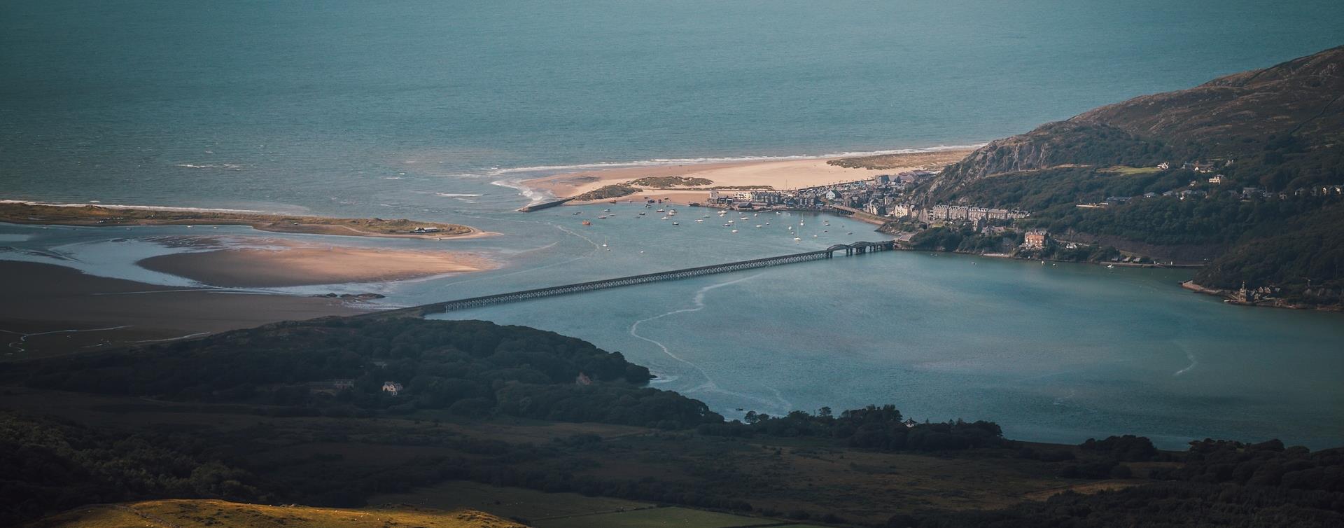
Barmouth
To the north of Barmouth near Tal-y-bont, Bennar's fine, sandy beach is backed by the occasional sand dune.
Machynlleth
The Cors Dyfi reserve in the heart of the UNESCO Dyfi Biosphere is a mixture of bog, swamp, wet woodland and scrub supporting a plethora of animals and plants, including the magnificent ospreys and the recently introduced beavers.
Gwynedd
Barmouth is southern Snowdonia’s most popular seaside resort. In summer, its big sandy beach is a magnet for visitors, yet there’s so much space along miles of unbroken sands that it never gets overcrowded.
Southern Snowdonia
Cadair Idris is a spectacular mountain reserve in southern Snowdonia with a variety of landscapes and terrain that cover over 450 hectares of breathtaking landscape.
Machynlleth
Machynlleth railway station is on the Cambrian Line from Shrewsbury to Aberystwyth. Trains also depart from here for the Cambrian Coast Line to Pwllheli.
Gwynedd
Aberdyfi is a charming coastal village in Southern Snowdonia, boasting a stunning beach with views of Cardigan Bay and opportunities for sailing and watersports. The area is also home to a nature reserve and Ramsar site.
Nr Corris
Abercorris Nature Reserve in southern Snowdonia is a three acre site of remnant broadleaved woodland on the steep east bank of Afon Deri combining the woodland habitat with that of the mountain stream below.
Tywyn
Tywyn railway station is on the Cambrian Coast Line from Machynlleth to Pwllheli.
Corris
Start: Corris Craft Centre car park
Grid Reference: SH 750 078
Distance: 5 km . 3.1 miles
Shorter option: 2.3 km . 1.4 miles
Grade: Moderate (some steep sections)
Terrain: Tarmac road and firm tracks
Maps: OS Explorer - OL 23
Llwyngwril
Llwyngwril railway station is on the Cambrian Coast line from Machynlleth to Pwllheli.
Dinas Mawddwy
North-east of Machynlleth and south-east of Dolgellau, the village of Dinas Mawddwy is just to the side of the A470 at the junction with the mountain road to Lake Vyrnwy and Bala.
Near Abergynolwyn
The Mary Jones Walk retraces the route the 15-year-old Mary Jones walked 25 miles from Llanfihangel-y-Pennant, across the Welsh mountains, to Bala to get a Bible from Revd. Thomas Charles.
Gwynedd
Deep in the mountainous heart of mid Wales, nestling at the foot of Cadair Idris, lie the ruins of Castell y Bere. An atmospheric site, it is an outstanding example of a stronghold of the native Welsh princes.
Barmouth
Barmouth/Abermaw railway station is on the Cambrian Coast Line from Machynlleth to Pwllheli.The railway station is in the town centre.
Bala
Cycle routes through southern Snowdonia and the exciting scenery around Bala,
Gwynedd
Morfa Harlech is one of two extensive sand dune systems which make up much of the southern Snowdonia coastline, extending from the Mawddach estuary in the south to Black Rock Sands in the north west.
Morfa Mawddach
Morfa Mawddach railway station is on the Cambrian Coast Line from Machynlleth to Pwllheli and is located south-east of Barmouth, south of the Mawddach estuary.
Bala
The Bala & Penllyn area has a wide range of Walking Trails for everyone – including: all ability, children, heritage, scenic and mountain walks - and all through stunning mountain and lake scenery of southern Snowdonia.

© Visit Mid Wales 2026. All Rights Reserved

