Bwlch Nant yr Arian | Waymarked trails for walking and running

Book Tickets Online

About

Bwlch Nant yr Arian Visitor Centre sits at the head of a dramatic valley and has commanding views of Cardigan Bay and the Cambrian Mountains.

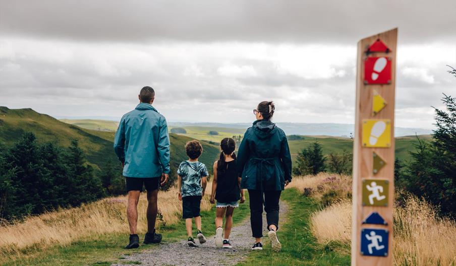
It is well-known for its long established tradition of daily feeding of red kites, Wales’s National Bird of Prey and there are trails for walkers, mountain bikers, and runners which are waymarked from the visitor centre.

All of the beautiful scenic walking trails start from the visitor centre.

MINERS' TRAIL (1.5 miles, 2.4 kilometres)
The Miners Trail winds along the head of the valley, following a leat which once carried water to power lead mines. It climbs a short but steep hillside towards the Giant’s Chair, a great place to take in the view. It then drops down across a forest road and into an area which has recently been planted with 12,000 native trees on its way back to the visitor centre.

BARCUD TRAIL (⅔ mile, 1.2 kilometres)
The Barcud Trail includes Animal Puzzle Trail and Elenydd Trail and leads you around the edge of the lake where the daily feeding of the red kites takes place (the Welsh for red kite is “Barcud Coch”). It is a circular level route suitable for wheelchairs and pushchairs.

Along the route there are wooden animals to spot - pick up an Animal Puzzle Trail leaflet from the dispenser or in the visitor centre and see how many animals you can find. Look out for sculptures and poetry along the path which bring local folklore and history to life – pick up an Elenydd Trail leaflet in the visitor centre.

RIDGETOP TRAIL (2.5 miles, 4.1 kilometres)
Follow the waymarkers up onto the heather clad ridge and enjoy the views of Cardigan Bay and the Cambrian Mountains. Head past the stone viewpoint before dropping down through the trees. Join the narrow leat path which brings you back to the car park.

Book Tickets

Guide Prices

Car parking

£1.50 parking fee for up to two hours
£3 parking fee for over two hours

Facilities

Accessibility

  • Disabled toilets
  • Wheelchairs available

Booking & Payment Details

  • Credit cards accepted (no fee)

Catering

  • On-site catering
  • On-site light refreshments
  • Picnic site

Children

  • Baby changing facilities
  • Children welcome

Groups

  • Education/study area
  • Facilities for educational visits

Parking

  • Parking with charge

Property Facilities

  • Gift shop
  • Public toilets

Routes

  • Accessibility of route - Accessible lakeside trail
  • Moderate Route

Site Features

  • Regional Tourist Board Member

Target Markets

  • Coach parties accepted

Map & Directions

Road Directions

Bwlch Nant yr Arian Forest Visitor Centre is 9 miles east of Aberystwyth on the A44 towards Llangurig and the visitor centre car park is signposted on the left. Bwlch Nant yr Arian Forest Visitor Centre is on Ordnance Survey (OS) Explorer map 213. For satellite navigation, the postcode is SY23 3AB. Car Parking Charges: Please pay at the ticket machine in the car park on arrival. The ticket machine takes cards and coins. It does not give change.

Public Transport Directions

The nearest mainline train station is Aberystwyth ( 9 miles). The 525 bus from Aberystwyth - Ponterwyd/Llanidloes stops on request at the entrance to the car park. For details of public transport visit the Traveline Cymru website.

Bwlch Nant yr Arian | Walking Trails (NRW)

Type:Walking Route

Bwlch Nant yr Arian, Bwlch Nant yr Arian Visitor Centre, Ponterwyd, Aberystwyth, Ceredigion, SY23 3AB

Add Bwlch Nant yr Arian | Walking Trails (NRW) to your Itinerary

Close window

Call direct on:

Tel0300 065 3000

Related

Bwlch Nant yr Arian | View of the LakeBwlch Nant yr Arian | Forest & Visitor Centre (NRW), AberystwythBwlch Nant yr Arian Visitor Centre sits at the head of a dramatic valley and has commanding views of Cardigan Bay and the Cambrian Mountains.

Bwlch Nant yr Arian Visitor Centre | Cafe & ShopBwlch Nant yr Arian | Cafe & Shop (NRW), AberystwythPerched on a hilltop near Aberystwyth, Bwlch Nant yr Arian is famous for feeding red kites daily. Range of waymarked walking, mountain biking, running and horse-riding trails and a mountain bike skills park. Café, shop and play area.

Bwlch Nant yr Arian | Walking trails with viewsBwlch Nant yr Arian | Running Trails (NRW), AberystwythBwlch Nant yr Arian is famous for feeding red kites daily. Range of waymarked walking, mountain biking, running and horse-riding trails and a mountain bike skills park. Café, shop and play area.

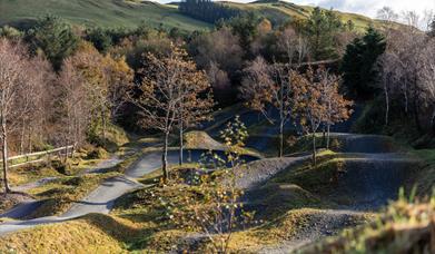
Bwlch Nant yr Arian | Mountain Bike Skills ParkBwlch Nant yr Arian | Mountain Biking (NRW), AberystwythMid Wales is a serious stop off and venue for people wishing to improve their dirt jump and pump track skills and the Mountain Bike Skills Park at Bwlch Nant yr Arian equips people to more safely enjoy their cycling out on the existing mountain bike trails.

What's Nearby

  1. Bwlch Nant yr Arian Visitor Centre sits at the head of a dramatic valley and has…

    0 miles away
  2. The Silver Mountain Experience is where history, myth and legend collide in a fantastic…

    0.94 miles away
  3. Enjoy the free guided tours around the Power Station including the fish farm & visit our…

    1.02 miles away
  4. The Rheidol Valley or 'Cwm Rheidol' is a good choice for a touring day out, featuring…

    1.46 miles away
  1. The Magic of Life Butterfly Centre is a must-visitor attraction for all nature lovers! It…

    1.73 miles away
  2. Coed Rheidol is situated about 12 miles east of Aberystwyth. It occupies parts of both…

    2.47 miles away
  3. Devil's Bridge Waterfalls is a spectacular 300 ft waterfall attraction at Devil's Bridge…

    3 miles away
  4. Discover the awe-inspiring beauty of Pumlumon, aptly named "five peaks," as it stands as…

    3.83 miles away
  5. Just three miles from Aberystwyth, Gogerddan is an easy-to-find woodland with a small…

    5.45 miles away
  6. The Hafod Estate | Hafod Uchtryd, 12 miles south-east of Aberystwyth, is recognised as…

    5.56 miles away
  7. The National Library of Wales is one of the world's great libraries. It is a legal…

    7.73 miles away
  8. Historic landscape with dramatic walks, waterfalls and views. The Hafod Forest occupies…

    7.85 miles away
  9. All aboard for an unforgettable 12 mile journey from Aberystwyth to Devil's Bridge…

    8.17 miles away
  10. Ever wanted to be a Steam Train driver? Well now it’s your chance!

    Drive a steam…

    8.28 miles away
  11. At the northern end of Aberystwyth promenade, Constitution Hill rises dramatically from…

    8.32 miles away
  12. The Aberystwyth Electric Cliff Railway is the longest in Britain and the only one in…

    8.32 miles away
Previous Next

Don't Miss

Don't Miss

Don't Miss

Don't Miss

Don't Miss