to add an item to your Itinerary basket.


Book Tickets Online
About
Talgarth is a small, peaceful market town (population approximately 2,000) at the foot of the Black Mountains.
That peace is interrupted only by the sound of graceful gliders being lifted into the skies above, passing pony-trekkers, Friday's livestock market and the annual events of Talgarth Festival in August and Talgarth Walking Festival in May.
Close to Brecon, Crickhowell and Hay-on-Wye, Talgarth provides an ideal base for visitors wishing to explore both the Black Mountains and the eastern end of the Brecon Beacons. With the Wye valley to the north and the Usk valley to the east, Talgarth is ideally located for a holiday in this beautiful part of Wales.
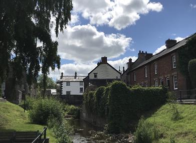
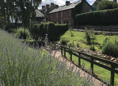
In the centre of the town lies a fully restored working water mill, set amongst historic stone buildings and the babbling River Ennig. The mill is home to a café, bakery and craft shop. If you have time, take a tour with the millers or discover the town’s gentle riverside walks. Just across the market square is the volunteer-run Tourist Information Centre, located in the medieval pele tower. Once used to guard the town's bridge, it now welcomes visitors for information, guidebooks, souvenirs and a chat.
Elsewhere within the town can be found a quality butchers shop, delicatessen, fruiterers, ice cream parlour and cosy pubs. A warm welcome awaits at each. This makes Talgarth the ideal base to stock up on refreshments before exploring the Black Mountains and surrounding area, or as a place to break up a longer journey.
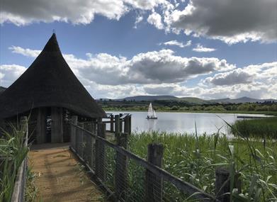
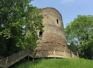
If the Black Mountains and stunning surrounding countryside are not enough, just on the edge of Talgarth are Llangors Lake, Bronllys Castle and Pwll-y-Wrach nature reserve and waterfalls. Three tranquil places to take in views of the surrounding area.
According to traditional accounts, Talgarth was the capital of the early medieval Welsh Kingdom of Brycheiniog.
Grwyne Fawr Mountain Bike Route
Starting at Talgarth, this Black Mountains classic route, to the Grwyne Fawr Reservoir, is 32 miles, 52km long. It is a genuine black (difficult) route reaching heights of 700m with very open hill country.
Events
Friday, 3rd May 2024 - Monday, 6th May 2024
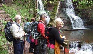 Talgarth Walking FestivalExplore the area with our knowledgeable leaders who will take you on journeys through the landscape from the wooded dingles to the Black Mountains plateau.
- more info
Facilities
Accessibility
- Disabled toilets
Booking & Payment Details
- Cash Point - Within Co-op
Catering
- Picnic site - Picnic sites - Riverside, town square pavilion and 'shade garden' opposite Tower Hotel.
Parking
- Free Parking - Free parking in main car park
Property Facilities
- Public toilets
Map & Directions
Road Directions
From Hereford - A438 to Bronllys/A479; From Abergavenny - A40/A479; From Builth Wells - A470 to Bronllys/A479.
Public Transport Directions
Accessible by Public Transport: Abergavenny train station is 20 miles away.