to add an item to your Itinerary basket.


Book Tickets Online
About
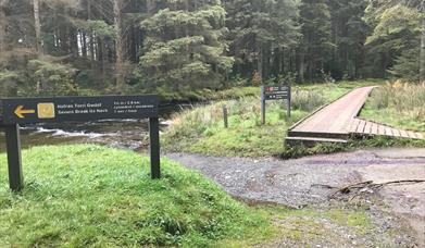
The Source of the Severn Trail starts in the Hafren Forest which is named after Afon Hafren (the Welsh name for the River Severn). You can pick up two long distance trails Glyndwr's Way National Trail and the Severn Way Trail which follows the Severn on it's long journey to the Bristol Channel.
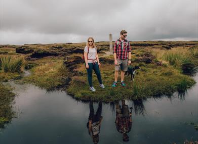
In the heart of the Cambrian Mountain uplands of Mid Wales, the River Severn springs from the upper slopes of Pumlumon Cwmbiga. A post marks the spot where the Severn begins it's 220 mile journey through Mid Wales and the borderlands.
Three of Mid Wales' great rivers rise in the mountainous landscape of the Pumlumon Massif; the River Severn, the River Wye and the River Rheidol.
The River Severn takes a 220 miles route through Powys and on towards the Welsh borderlands. The River Wye takes a shorter 134 mile route through the ancient Welsh county of Radnorshire and on south through Monmouthshire and the River Rheidol has a short 19 mile journey joining the sea at Aberystwyth.
The Source of the Severn Trail
The OS grid reference is SN 857 869.
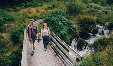
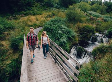
The Source of the Severn trail sets out on a well-surfaced path with compact gravel and loose stones. The there-and-back section to the source of the Severn is on stone slabs and a path of loose stone; there may be sheep on this section. The return route is via forest road and a narrow loose shale riverside path. Some steep ascents and descents and several benches along the route.
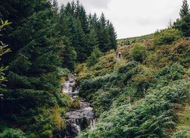
The Source of the Severn Trail leads alongside the river and through the forest to Blaen Hafren Falls.
Follow the white waymarkers. When reaching the forest boundary the final section of the Source of the Severn trail is via a stone path which passes through some very boggy and wet moorland which is part of the Pumlumon SSSI. The Source of the Severn itself is marked by a large wooden post and lies at 620m, 2034ft.
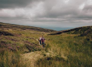
When you have reached the source of the Severn it is worthwhile continuing straight ahead on the stone path and over a stile. You will see some fantastic views towards the coast, and on your right are the mountains of Snowdonia.
When re-entering the forest from the Source turn right on the forest road following the white waymarkers for approx 1 mile until you reach a waterfall. Follow the waymarked path downhill past a Bronze Age opencut copper mine and then past the ruins of Nant yr Eira lead mine. Keep following the route down to Afon Hore and all the way back to the first bridge you crossed.
It is also possible to reach Pen Pumlumon Arwystli (741m) by following the maps on site. The views from there are staggering and well worth the climb and extra 3.7km or 2.3 miles (1.5 additional hours).
Book Tickets
Facilities
Accessibility
- Disabled toilets
Catering
- Picnic site
Parking
- Free Parking
Property Facilities
- Public toilets
Routes
- Accessibility of route
- Difficult Route
- Length of route (km) - 13 km
- Length of route (miles) - 8 miles
- Typical duration of route - 4.5 hours
Map & Directions
Road Directions
From Llanidloes town centre face the Market Hall from Great Oak Street and take Short Bridge Street directly opposite. Follow the narrow road to Old Hall. The Rhydybenwch picnic site is 6 miles west of Llanidloes. It can also be reached from the northern end of Llyn Clywedog on minor roads.
OS Grid Reference: SN857869