to add an item to your Itinerary basket.


Book Tickets Online
About
Section 2 - Total distance 7.7km (4.8 miles)
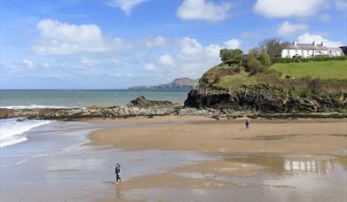
Characterised by high cliffs and secluded beaches, much of this section is heritage coast. The waterfall at Tresaith beach is a particularly unusual feature and was created when glacial activity diverted the river Saith.
Aberporth to Tresaith
Distance 3.2km (2 miles), grade - easy/moderate
An all weather, surfaced cliff-top path between these villages affords some spectacular views. The southern half is wheelchair friendly.
Tresaith to Penbryn
Distance 2.6km (1.6 miles), grade - moderate/hard
The steep coastal slope forces the path inland slightly here resulting in a long climb to a height of 125 metres.
Penbryn to Llangrannog
Distance 2.9km (1.8 miles), grade - hard
Again the nature of the coastline makes the path less intimate with the sea here and with two steep climbs in such a short distance this is one of the toughest sections of the Ceredigion Coast Path.
Book Tickets
Facilities
Parking
- Free Parking
- Parking with charge
Routes
- Description of route - 2nd Section Ceredigion Coastal Path
- Length of route (miles) - 12
Map & Directions
Road Directions
Off the A487 between Cardigan and Aberaeron.
Accessible by Public Transport: Aberystwyth station is 35 miles away.