Dyfi Discovery Walk | Pennal Walk

Book Tickets Online

About

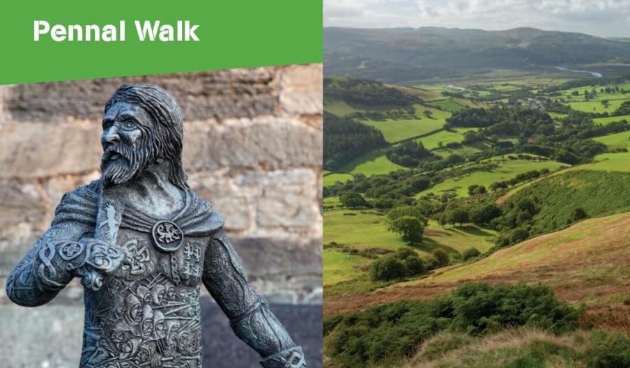
This walk starts in the village of Pennal close to the Dyfi estuary.  The village is best known for its historical association with Owain Glyndwˆ r, the last native Welshman to hold the title Prince of Wales. He instigated a fierce and long-running but ultimately unsuccessful revolt against English rule in Wales. In 1406, Owain Glyndwˆ r wrote from Pennal to Charles VI of France, pledging that Welsh bishops would pay allegiance to the French Pope, Benedict XIII, if only France would come to his aid by organising a crusade against Henry IV of England. Charles VI replied with encouragement but little else.

St Peter’s Church in Pennal was originally founded in the 6th century by Celtic missionaries, St Tanwg and St Eithrias. In the church is a facsimile of Owain Glyndwˆ r’s letter to Charles VI, and a painting of the great assembly he called. Llywelyn Goch, a famed 14th Century Welsh poet, wrote one of the finest and most poignant lovepoems in Welsh.

The story goes that Lleucu had fallen in love with Llywelyn Goch ap Meurig Hen (son of Old Meurig), but her father didn't like him. Llywelyn had to travel down to South Wales but promised Lleucu that he'd come back and marry her.  However, in his absence, Lleucu's father told her that Llywelyn had married someone else, and poor Lleucu died of a broken heart. Llewelyn soon returned to marry her, but instead buried his bride-to-be under the altar in St Peter’s church.

Discovery Walk starts in Pennal village
Grid Reference: SH 699 004 | Distance: 13.2km – 8.3 miles | Maps: OS Explorer – OL 23
Grade: Strenuous – A mountain walk, not to be undertaken in poor visibility
Terrain: Tarmac road, firm tracks, woodland, open moorland with boggy, tussocky ground, fields. Route sometimes undefined
Refreshments: Riverside Hotel, Plas Talgarth restaurant and village shop

1. Start from bridge in the village A and walk away from the main road to follow Wales Coast Path signs up a side road past two large chapels to go out of the village.

2. At a fork turn R and then further on turn R up a forestry track, past a parking area on the L, and keep L at the next 2 forks to cross a bridge. Walk L around the hairpin bend to follow the track uphill, until it bears sharp L in front of a twin telegraph pole.

3. Here turn R down the bank and then L and on across the hillside, going L at the fork, and on up through a woodland, ignoring any turnings on the L before swinging L and down B to reach a forestry track, then turn L to the end of the track. Just inside the trees turn R over a FB, and follow the path uphill and through woods and garden to Maesywerngoch. Go through a gateway into the courtyard and exit through a G on the opposite side, and take the descending access track. Where it swings R continue ahead along signposted path, cross a S and FB, and then follow the path up the hill and on as it veers L at the base of a slope. At a junction next to a wall fragment turn L to reach another forestry track, turning L again to walk downhill to a G and S.

4. Over this and immediately R uphill before bearing L to follow a faint boggy track with clearfell to the R. This gradually closes with the stream on the L to cross over a small FB. Turn L to walk up the bank, then R and on up to cross a forestry track to a steeply ascending path up a firebreak C in the trees.

5. Emerging at the top, go R through a G, and continue along a moorland path D with a fence on your L, around the head of Cwm Breichiau heading for the gap between the 2 hills ahead. Climb a S and walk to the end of the fence. Bear L and contour the side of the hill, before veering L down a faint path which eventually joins a track below and turn L.

6 Where track bends L, turn R to walk down the bank, through a G, and across the field on a faint path to the R of the ridge crest. Go through a gate opening and then bear L uphill towards a waymarker post. Continue in the same direction, to a second and third post E. Drop down half R to find a G and track which descends the LH side of the ridge. Continue down the track until it peters out and then downhill veering slightly to the L to reach another track and follow it down beside the valley, through a G and on with the steam on the L.

7. Where it bends L go up the bank, keeping the fence on your R and continue down through a G, with fence on R to turn R at a track. Go through G, then walk downhill to cross a CG and road bridge and on along lane to join your outward route at 2 and retrace your steps back to the village.

Book Tickets

Facilities

Routes

  • Description of route - Strenuous
  • Length of route (miles) - 8

Map & Directions

Dyfi Discovery Walk | Pennal Walk

Type:Walking Route

Pennal, MACHYNLLETH, Powys, SY20 9DR

Add Dyfi Discovery Walk | Pennal Walk to your Itinerary

Close window

Call direct on:

Tel0300 065 3000

Related

mid wales, machynlleth, town, holidays, visitingMachynlleth, MachynllethUnwind in the heart of the Dyfi Biosphere at Machynlleth. Part of the UNESCO Dyfi Biosphere and offers exciting activities, from mountain biking to exploring the natural beauty of Mid Wales. The Centre for Alternative Technology is an excellent place to learn about environmentalism, while the…

Llyn BarfogDyfi Discovery Walk | Llyn Barfog Walk, TywynStart: Snowdonia National Park Authority car park, Cwm Maethlon/Happy Valley Grid Reference: SN 640 986 Distance: 5 km - 3.1 miles (shortcut 4 km – 2.5 miles) Grade: Moderate Terrain: Open moorland, firm tracks, fields and tarmac road.

Centre for Alternative TechnologyDyfi Discovery Walk | Centre for Alternative Technology Walk, MachynllethStart: Centre for Alternative Technology (C.A.T) car park Grid Reference: SH 754 044 Distance: 7.1 km – 4.4 miles Grade: Moderate (some steep sections) Terrain: Firm tracks, roads and open grassland Maps: OS Explorer OL23 or 215

Dyfi Discovery Walk | Ceinws to Llanwrin WalkDyfi Discovery Walk | Ceinws to Llanwrin Walk, MachynllethStart: Ceinws village Grid Reference: SH760 059 Distance: 11.3 km – 7 miles (additional 0.7km - 0.4 miles to Llanwrin) Grade: Moderate / Strenuous Terrain: Firm tracks, open fields Maps: OS Explorer 215

Dyfi Discovery Walk | Cwrt WalkDyfi Discovery Walk | Cwrt Walk, MachynllethStart: Village car park, Cwrt Grid Reference:SH 688 000 Distance: 4.8 km – 3 miles (with extension 6.6 km - 4 miles) Grade: Moderate (extension energetic) Terrain: Tarmac road, firm tracks, fields and woodland Maps: OS Explorer - OL 23

Y Plas Machynlleth - starting point for Machynlleth to Morben WalkDyfi Discovery Walk | Machynlleth to Dyfi Wildlife Centre, MachynllethThis walk starts at the car park at Y Plas, Machynlleth and is graded as moderate. The terrain includes road, woodland paths, firm tracks and fields and is a distance of 5 miles.

Dyfi Discovery Walk | Derwenlas WalkDyfi Discovery Walk | Derwenlas Walk, MachynllethStart: Lay-by Derwenlas Grid Reference: SN721 991 Distance: 6.2 km - 3.8 miles Grade: Moderate Terrain: Firm tracks, open fields, some boggy areas Maps: OS Explorer OL23

Dyfi Discovery Walk | Cwm Ralltgoed WalkDyfi Discovery Walk | Cwm Ralltgoed Walk, MachynllethStart: NRW forest car park. Turn R just before Aberllefenni village sign. Grid Reference: SH 769 092 Distance: 8.4 km - 5.2 miles Grade: Easy/Moderate Maps: OS Explorer . OL23

Dyfi Discovery Walk | Cae Adda WalkDyfi Discovery Walk | Cae Adda Walk, MachynllethStart: Near Dovey Valley Shooting Centre Limited car parking Grid Reference: SH 806 051 Distance: 10 km – 6.2 miles Grade: Moderate with some steep sections Terrain: Fields, rough tracks Maps: OS Explorer - 215

What's Nearby

  1. The Church of St Peter Ad Vincula

    Tucked away in the foothills of Cadair Idris Country, the peace and simplicity of this…

    0.08 miles away
  2. The Dyfi Wildlife Centre near Machynlleth is the home of the Dyfi Osprey Project at the…

    1.16 miles away
  3. The Cors Dyfi reserve in the heart of the UNESCO Dyfi Biosphere is a mixture of bog,…

    1.16 miles away
  4. Dolgoch Falls railway station is a station on the Talyllyn Railway between Tywyn and…

    2.79 miles away
  1. RSPB Ynys-Hir nature reserve is a wildlife haven in the heart of Mid Wales . Explore oak…

    2.86 miles away
  2. Y Plas Machynlleth is a Grade 2 listed building, set in parkland offering a unique…

    2.9 miles away
  3. The Dyfi Valley opens wide as it approaches Cardigan Bay Coast and ends in sandy beaches…

    2.9 miles away
  4. Throughout the year MOMA WALES shows Modern Welsh Art, in a series of constantly changing…

    2.91 miles away
  5. Experience the Wonder of Dyfi Biosphere: A Natural Gem Recognised by UNESCO

    Discover the…

    2.94 miles away
  6. The Dyfi Furnace near Machynlleth is a restored mid-eighteenth-century charcoal-fired…

    3.34 miles away
  7. The Dolgoch Falls are a series of three waterfalls near Tywyn in Southern Snowdonia.…

    3.95 miles away
  8. The Centre for Alternative Technology (CAT) is a world-renowned eco centre in Mid Wales…

    4.27 miles away
  9. Deep in the mountainous heart of mid Wales, nestling at the foot of Cadair Idris, lie the…

    5.54 miles away
  10. Discover quality craftsmanship and the unique stories behind the handmade designs in 9…

    5.62 miles away
  11. Sail underground, through the magical veil of a waterfall, and pass into a mythical world…

    5.62 miles away
  12. Corris Caverns is the name for the fantastic attractions and experiences that start from…

    5.62 miles away
Previous Next

Don't Miss

Don't Miss

Don't Miss