Book Tickets Online
About
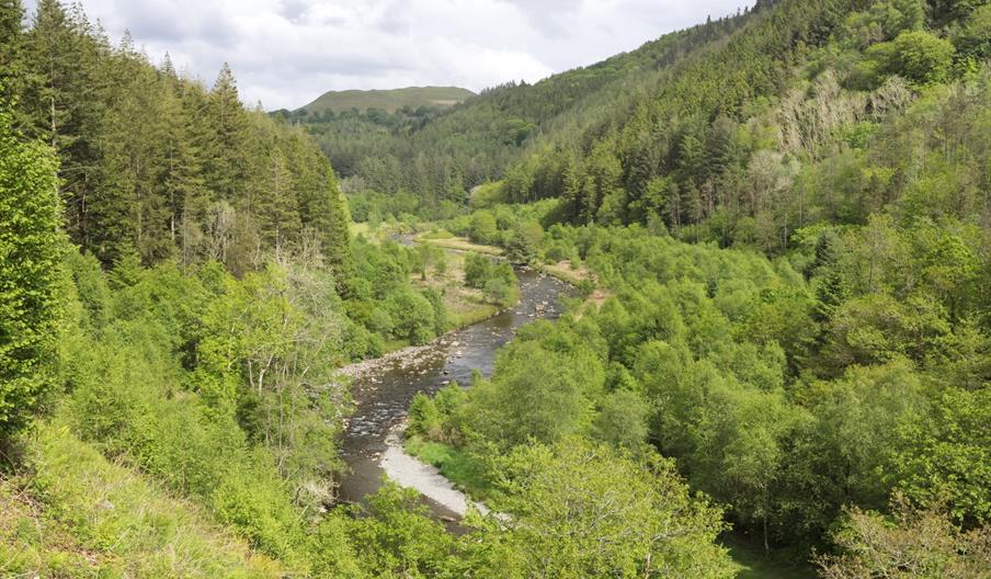
The Hafod Forest occupies some 200 hectares of the Ystwyth valley and surrounding hills. The walking trails explore a landscape that varies widely in character from grazed parkland and different types of woodland to the River Ystwyth gorge with its bridges and waterfalls (these are especially dramatic after wet weather).
THE HAFOD ESTATE - HISTORICAL HAFOD WALKS
There are some 15km (8-9 miles) of waymarked paths available to walkers at Hafod – most follow historical routes. You can also use the network of Public Rights of Way at Hafod (see Ordnance Survey Explorer map 213 for more information).
The Hafod Car Park picnic area is the gateway to the five historical walks which allow you to discover the picturesque Hafod Estate. Walks leaflets are available from a dispenser in the car park (dispenser requires 2 x £1 coins).
HAFOD WALKING TRAILS
Bedford Monument Walk (1 mile, 1.6 kilometres) | Grade: Moderate
A walk with a relatively gentle gradient up to the Bedford monument from where you can enjoy a beautiful view over the estate. The trail does a circuit of Cefn Creigiau ridge and avoids the steep descent to the valley floor. It is not one of Johnes’ historical circuits, but it goes to a moment erected in 1805 to commemorate the fifth Duke of Bedford.
Coed Hafod Walk (¾ mile, 1.2 kilometres one way) | Grade: Moderate
This short walk runs west along the south-facing slope of the Ystwyth Valley and offers stunning views across the Hafod Estate. It passes through several different types of woodland and there is the option to join a different trail to complete a circular walk back to the car park.
Ystwyth Gorge Walk (1 mile, 1.6 kilometres) | Grade: Moderate
This spectacular route takes you across the rocky gorge on a wobbly (but safe!) narrow chain bridge. Experience the dramatic River Ystwyth gorge from the Chain Bridge, especially after heavy rain. There are some climbs and descents along the way and steep drops beside the path.
The Lady’s Walk (includes the Garden Walk) (2¼ miles, 3.6 kilometres) | Grade: Moderate
This walk is one of two classic circular routes created by Johnes in his first years at Hafod. It takes you through a lovely meadow and past a stunning waterfall along paths with a gentle gradient. Along the route, there is a choice between the Garden Walk – a narrow but fairly level woodland path that passes through the Flower Garden – or the meadow path that continues along the riverside.
The Gentleman’s Walk (3¾ miles, 6 kilometres one way or 5¾ miles, 9 kilometres total distance from car park and back via Lady’s Walk to starting point) | Grade: Strenuous
This spectacular walk is the second “Picturesque” circuit created by Johnes. It takes in huge old beech trees, the amazing Cavern Cascade, Rustic Bridge, Tunnel and Mossy Seat Falls on this historic trail. It is a strenuous walk with many steep climbs and descents.
All of the walking trails are waymarked and start from The Hafod car park.
You can download a PDF of the trails before your visit or purchase the guide map produced by the Hafod Trust from the onsite dispensing machine (takes 2 x £1 coins) or by post from the Hafod Trust office.
Please note:
Sometimes we need to close or divert trails for your safety whilst we undertake maintenance work or forest operations.
Occasionally we may have to close a site in extreme weather, such as high winds or snow and ice due to the risk of injury to visitors or staff.
Please always follow any instructions onsite and make sure you follow any temporary diversion signs in place.
Book Tickets
Facilities
Accessibility
- Disabled access
Children
- Children welcome
Parking
- Free Parking
Property Facilities
- Dogs Accepted
- Public toilets
Target Markets
- Accepts groups
Map & Directions
Road Directions
HAFOD CAR PARK - OS Grid Reference: SN 768 737
From the Hafod Arms Hotel in Devil's Bridge take the B4574 to Cwmystwyth. Pass the The Arch car park and proceed downhill. Turn right shortly after passing the "Cwmystwyth" sign. Go past ADAS Pwllpeiran and proceed to a T junction and turn right. Pass Hafod Church and turn left into Hafod Car Park.
HAFOD ARCH CAR CARK- OS grid reference is SN 765 756.
Take the B4574 from Devil's Bridge to Cwmystwyth. Approximately three kilometres from Devil's Bridge, you pass a stone arch on the left and the car park and picnic area is just after it.
Accessible by Public Transport: Aberystwyth station is 12 miles away.


 to add an item to your Itinerary basket.


