To provide you with the best experience, cookies are used on this site.  Learn more

Allow cookies
Abergorlech Forest Garden Brechfa - NRW

Book Tickets Online

About

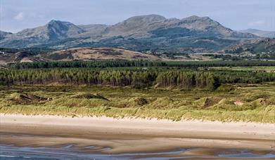
Up to the early Middle Ages the areas north of the river Cothi were heavily wooded, forming the Forest of Glyncothi, vital to the defence and independence of the Welsh principality of Deheubarth.

Following the final defeat of Wales by Edward I in 1283, Glyncothi became a Royal Forest administered under the harsh Forest Law. Forest Law involved severe punishment for offences against both 'venison' and 'vert'. The 'vert' included trees, coppices, the underwood and feeding ground of the game. Venison covered all the forest animals - in medieval Glyncothi these included red deer, fallow deer and roe deer, wild boars, wolf, fox, hare and pine marten. Forest Law was finally abolished in 1640, with most of the ancient oakwoods felled and cleared by the 17th century.

As well as playing its part in the industrial revolution, timber was taken from the forest during the First World War to produce naphtha for use in making explosives.

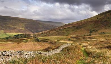
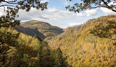
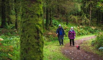
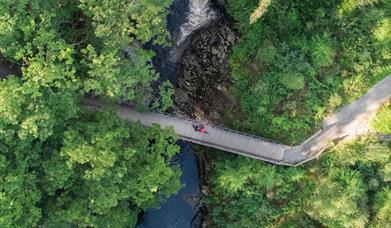
Today a very different forest has returned. The heavy use of timber in the First World War resulted in the creation of state forests and the Forestry Commission. Today Brechfa Forest covers some 6500 hectares and is looked after by Natural Resources Wales for the benefit of people, wildlife and timber production. There are walking and mountain bike trails for you to enjoy, with horseriders welcome on forest roads.

The OS grid reference is SN 585 340
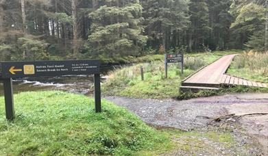
Byrgwm Picnic Site

A pleasant picnic site situated under a canopy of red oak trees. The site has ample parking.
4 mile Byrgwm Forest Trail. Open acess for horse riding in this area
OS Grid Reference: SN585340


Byrgwm Woodland

A middle distance forest walk which undulates through a mixture of mature Douglas Fir, broad-leaved wood, clear-felled areas and forest tracks.
Length of Trail: 4 Miles
Approx Time: 2hours

Abergorlech Picnic Site

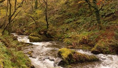
Abergorlech Picnic Site is in a lovely location where the Gorlech and Cothi Rivers meet.There is a childrens' play area and accessible picnic facilities.
OS Grid Reference: SN587338

Abergorlech Woodland

Abergorlech is home to a picnic site with childrens' play area,where the Gorlech and Cothi rivers meet.

Strangely shaped stones have been found in the river, and examples of these Gorlech Stones can be seen in the village front gardens.

Sifigwm

Gateway to the Gorlech MB trail

This is an alternative starting point for the Gorlech mountain bike trail with ample parking and information boards.Grid Ref: SN 553394

The Gorlech Trail

The Gorech Trail is the first of three new mountain bike trails for the forest. Designed by Rowan Sorrell, the route is made up of
three big climbs and descents stretching over its 19km.

Please note:

Sometimes we need to close or divert trails for your safety whilst we undertake maintenance work or forest operations.
Occasionally we may have to close a site in extreme weather, such as high winds or snow and ice due to the risk of injury to visitors or staff.
Please always follow any instructions onsite and make sure you follow any temporary diversion signs in place.

Book Tickets

Facilities

Children

  • Children welcome

Parking

  • Free Parking

Property Facilities

  • Dogs Accepted

Target Markets

  • Accepts groups

Map & Directions

Road Directions

The A482 (Lampeter to Llandovery), the A40, and the A485 (Lampeter to Carmarthen) encompass the forest. There are numerous roads that lead to Brechfa Forest, and Abergorlech and Brechfa are small villages located next to Brechfa Forest on the B4310 road. Follow the A482 between Lampeter and Llandovery until the turn off for Llansawel (B4302). Once in Llansawel follow signs for Abergorlech.

Brechfa Forest (NRW)

Type:Forest or Woodland

Abergorlech, Carmarthenshire

Add Brechfa Forest (NRW) to your Itinerary

Close window

Call direct on:

Tel0300 065 3000

Related

Harlech Beach & DunesMorfa Harlech Nature Reserve (NRW), HarlechMorfa Harlech is one of two extensive sand dune systems which make up much of the southern Snowdonia coastline, extending from the Mawddach estuary in the south to Black Rock Sands in the north west.

Brecon Beacons | Craig CerrigCraig Cerrig Gleisiad & Fan Frynych (NRW), BreconCraig Cerrig-gleisiad and Fan Frynych National Nature Reserve is a 156 acre (631,000 m²) area of the Brecon Beacons National Park.

Rheidol ValleyCoed Rheidol Nature Reserve (NRW), Devil's BridgeCoed Rheidol is situated about 12 miles east of Aberystwyth. It occupies parts of both banks of the Afon Rheidol, upstream, and the south bank downstream of Devil's Bridge.

Crychan Forest and Halfway ForestCrychan Forest (NRW), Llangammarch WellsThe Crychan & Halfway Forest is set in beautiful countryside nestling between the Brecon Beacons & the Cambrian Mountains. Miles of waymarked trails for horse riding, cycling and walking take you through tranquil gorges, along old drover's routes & past cascading waterfalls.

Coed y Brenin Forest ParkCoed y Brenin Visitor Centre (NRW), DolgellauCoed y Brenin Visitor Centre is in the heart of southern Snowdonia near Dolgellau, is the gateway to Coed y Brenin Forest Park. Try world-class mountain bike trails, family walks, café, cycle shop, all-ability play area and an easy access trail.

Lake VyrnwyDyfnant & Vyrnwy Forests (NRW), Lake VyrnwyDyfnant and Vyrnwy Forests are in a part of Mid Wales renowned for rolling hills, lush green valleys and picturesque farmsteads and villages. The Forest caters for horse riding and carriage driving as well as walking and picnic areas.

Dyfi Forest - Nant GwernolDyfi Forest (NRW), MachynllethThe Dyfi Forest is located mainly to the north of the Afon Dyfi between Dolgellau to the north and Machynlleth to the south. Dyfi is a 6000ha forest - a spectacular landscape well worth exploring.

Ceri Forest - NRWCeri Forest (NRW), NewtownCeri Forest is a coniferous forest which sits astride the Kerry Ridgeway in the uplands of Montgomeryshire.

Hafren ForestHafren Forest (NRW), LlanidloesChoice of walking trails along the River Severn which flows through Hafren Forest. Trails go to waterfalls and the source of the Severn on Pumlumon. Riverside accessible trail with viewing platform over cascades. Picnic area and toilets.

Morfa DyffrynMorfa Dyffryn Nature Reserve (NRW), Dyffryn ArdudwyThe spectacular Morfa Dyffryn Reserve stretches for about 4.5 miles along the coast of Cardigan Bay from Afon Ysgethin in the south to Afon Artro in the north.

Coed y Brenin Forest Park (NRW), DolgellauCoed y Brenin Forest Park is set in Eryri (Snowdonia) National Park near Dolgellau and forms part of the National Forest for Wales. There are many walking trails from various car parks within the Coed y Brenin forest park where you can see waterfalls, ruins of a copper mine and have accessible…

Coed y Brenin CafeCoed y Brenin Visitor Centre | Meetings & Conferences (NRW), DolgellauCoed y Brenin visitor centre near Dolgellau, is the gateway to Coed y Brenin Forest Park. Try world-class mountain bike trails, family walks, café, cycle shop, all-ability play area and an easy access trail.

What's Nearby

  1. Talley Woodlands overlook an historic village and ruined abbey in Carmarthenshire, 12…

    3.01 miles away
  2. Allt Rhyd y Groes Nature Reserve

    The sessile oak wood at Allt Rhyd y Groes near Llandovery hangs onto the steep north-east…

    11.62 miles away
  3. A Welsh Garden with a Dutch History, Cae Hir is one of Wales' best loved private gardens.…

    11.76 miles away
  4. Six miles north from Llandovery, this woodland and picnic area is in the peaceful Tywi…

    12.25 miles away
  1. Denmark Farm is located in the heart of rural West Wales. Wildlife is at the heart of…

    12.58 miles away
  2. A working record of a great industry - see the traditional methods of making Welsh…

    14.6 miles away
  3. Teifi Valley Railway

    The Teifi Valley Railway was created from a branch line of the Great Western Railway…

    14.71 miles away
  4. This delightful reserve is set in the heart of Mid Wales near Ystradffin, Rhandirmwyn.…

    14.92 miles away
  5. The Usk Reservoir is a remote upland 280 acre reservoir surrounded by the Glasfynnedd…

    15.69 miles away
  6. Llyn Brianne is a spectacular reservoir at almost 300m (990ft) above sea level. It holds…

    15.69 miles away
  7. The Crychan & Halfway Forest is set in beautiful countryside nestling between the Brecon…

    16.36 miles away
  8. Llanerchaeron near Aberaeron is managed by the National Trust. The self-sufficient…

    17.47 miles away
  9. Wales' best kept secret for 315 million years! The National Showcaves Centre for Wales…

    17.51 miles away
  10. Cors Caron is a vast wetland near Tregaron. The huge raised peat bogs and surrounding…

    18.89 miles away
  11. The Castle overlooks Craig-y-Nos Country Park, in the Brecon Beacons National Park, an…

    19.48 miles away
  12. Aberaeron South Beach

    Aberaeron South Beach is a rock and shingle beach just to the south of the town and…

    19.65 miles away
Previous Next

Don't Miss

Don't Miss

Don't Miss

Don't Miss

Don't Miss