to add an item to your Itinerary basket.


Book Tickets Online
About
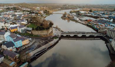
Cardigan to Gwbert
Distance 5.6km (3.5 miles), grade - easy
This section runs through farmland to the north of the River Teifi before following a roadside path along the side of the estuary. Heading away from Cardigan the estuary gradually reveals itself.
Gwbert to Mwnt
Distance 5.8km (3.6 miles), grade - easy
Currently this section is predominantly road walking though a new link which will run through farmland and then along the coastline is in development.
Mwnt to Aberporth
Distance 8km (5 miles), grade - moderate
A remote section of Coast Path that is positioned along the top of cliffs and coastal slopes and below the fringe of the agricultural land. The tranquilly and isolation of this section induces a feeling of separation from the pace of modern life.
As you approach Aberporth the path swings inland along Cwm Gwrddon in order to avoid the MOD base.
Book Tickets
Facilities
Parking
- Free Parking
- Parking with charge
Routes
- Description of route - 1st Section - Ceredigion Coastal Path
- Length of route (miles) - 12
Map & Directions
Road Directions
By Car: On the A487 from Fishguard or Aberystwyth.
Accessible by Public Transport: Fishguard & Goodwick station is 20 miles away.