to add an item to your Itinerary basket.


Book Tickets Online
About
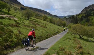
The Lôn Las Cymru (NCN Route 8) from Cardiff to Holyhead on through the Brecon Beacons, the Cambrian Mountains, and around the edge of Snowdonia is approximately 380km over four days, climbing around 1,000m per day.
Lôn Las Cymru Cycle Route: Rhayader to Llangurig Section: 11 miles one way, 22 miles return
Although this is not strictly a traffic free route, this minor gated road running down the Wye Valley carries next to no traffic as the main A470 runs parallel, on the other side of the valley, all the way from Llangurig to Rhayader. There is a .5 mile section on the slightly busier B4518 at the Rhayader end.
Start & Parking - Tarmac. Although the road follows the Wye Valley there are several gentle hills and the occasional steeper push. The river drops almost 250ft from Llangurig to Rhayader.
Map & Leaflet
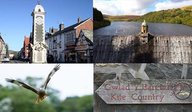
Ordnance Survey Landranger Map 136 or 147. The route is also covered by the Lon Las Cymru (north) map, produced by Sustrans - tel 0117 9290888
Book Tickets
Facilities
Accessibility
- Disabled toilets
Booking & Payment Details
- Cash Point
Catering
- On-site catering
- Picnic site
Property Facilities
- Gift shop
- Postbox
- Public toilets
Routes
- Length of route (miles) - 11
Target Markets
- Coach parties accepted